Riegl UK
Stand E16
RIEGL is a leading international manufacturer of cutting edge LiDAR technology for airborne, mobile, terrestrial, industrial and unmanned laser scanning solutions.
RIEGL has produced laser scanners using Ultimate LiDAR™ systems commercially for more than 40 years and focuses on pulsed time-of-flight laser radar technology in multiple wavelengths.
Our UK office, located on the outskirts of York, is ideally situated to deliver the best training services throughout the UK and Ireland.
Products

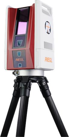
RIEGL VZ-600i 3D Terrestrial Laser Scanner
RIEGL‘s latest generation of professional Terrestrial Laser Scanners stands out with extreme versatility, high productivity, ultimate performance and additional mobility – providing an excellent return on investment!
The RIEGL VZ-600i offers a broad range capability from 0.5 m up to 1000 m and is suitable for indoor and outdoor 3D mapping applications. 3D position accuracy of 3 mm, less than 30 sec scan time for high-resolution scans with 6 mm point spacing at 10 m, enabling more than 60 scan positions/hour with real-time registration, weight less than 6 kg (13 lbs), 2.2 MHZ PRR, three internal cameras & GNSS integrated, and also prepared for mobile mapping applications – these key features will speed up your workflow in indoor and outdoor applications like AEC (Architecture, Engineering, Construction), BIM (Building Information Modeling), as-built surveying, forensic and crash scene investigation, archeology & cultural heritage documentation, forestry, and many more.

Riegl VZ-2000i Terrestrial Long Range 3D laser Scanner
Based on a future-oriented, innovative new processing architecture, internet connectivity, and RIEGL's latest waveform processing LiDAR technology, the RIEGL VZ-2000i Long Range 3D Laser Scanning System combines proven user friendliness in the field with fast and highly accurate data acquisition.
Its new processing architecture enables execution of different background tasks (such as point cloud registration, geo- referencing, orientation via integrated Inertial Measurement Unit, etc.) on-board in parallel to the simultaneous acquisition of scan data and image data. A full documentation of the scanner‘s software components – directly accessible on the RIEGL VZ-2000i – provides a sound basis for creation of your own python apps to enhance the scanner functionality. The system provides highest flexibility by supporting numerous peripherals and accessories such as the integrated GNSS unit for high accurate RTK solution, a SIM Card slot for 3G/4G LTE, WLAN, LAN, USB, and different other ports of external units.

Riegl VUX-120 UAV Laser Scanner
The RIEGL VUX-120²³ is a lightweight and versatile airborne laser scanner offering a wide field of view of 100 degrees and an extremely high pulse repetition rate of up to 2.4 MHz. Thus, it is perfectly suited for high point density corridor mapping applications.
The measuring beam of the RIEGL VUX-120²³ is consecutively emitted in three different directions: it alternates from strictly nadir, to +10 degrees forward, and to -10 degrees backward. This allows data acquisition with an unrivaled completeness in data capture, especially in challenging environments with vertical surfaces and narrow canyons.
The scanner provides an internal data storage capacity of 2 TByte and a removeable CFast card and is equipped with interfaces for integration of an external IMU/GNSS system. Additionally, interfaces for up to two optional external cameras are available.
The sophisticated design of the RIEGL VUX-120²³ allows smooth integration on UAS/UAV/RPAS, small manned aeroplanes (like gyro-copters), but also on helicopters. It is offered both, as stand-alone UAV LiDAR sensor and also in various fully-integrated UAV-based laser scanning system configurations with appropriate IMU/GNSS system and optional cameras. This allows the scanner to perfectly meet all the specific requirements of the customers‘ applications.
NEW: RIEGL offers a fully integrated VUX-series LiDAR solution with a high-precision inertial subsystem for localization and orientation (Localization/Orientation Component), the RiLOC-F.
The version of the RIEGL VUX-12023 includes a high-precision Micro Electro Mechanical System (MEMS) Inertial Measurement Unit (IMU), a GNSS unit, and appropriate software. All components are included in a compact and lightweight housing, that is directly attached to the scanner.
The combination of the LiDAR sensor and RiLOC-F into a compact complete LiDAR system is the ideal solution for small-scale LiDAR surveying with drones. In such applications, using a nearby local base station ensures the shortest base length and thus maximum accuracy in the georeferencing of the high-precision LiDAR data from the RIEGL VUX-series high-precision LiDAR sensor.